



 Featured
Jeep Safari
Alanya Mix Safari Tour with Zoo Visit and Boat Trip
Free Cancellation Free Shuttle
From £29.77 £26.91 Per Person



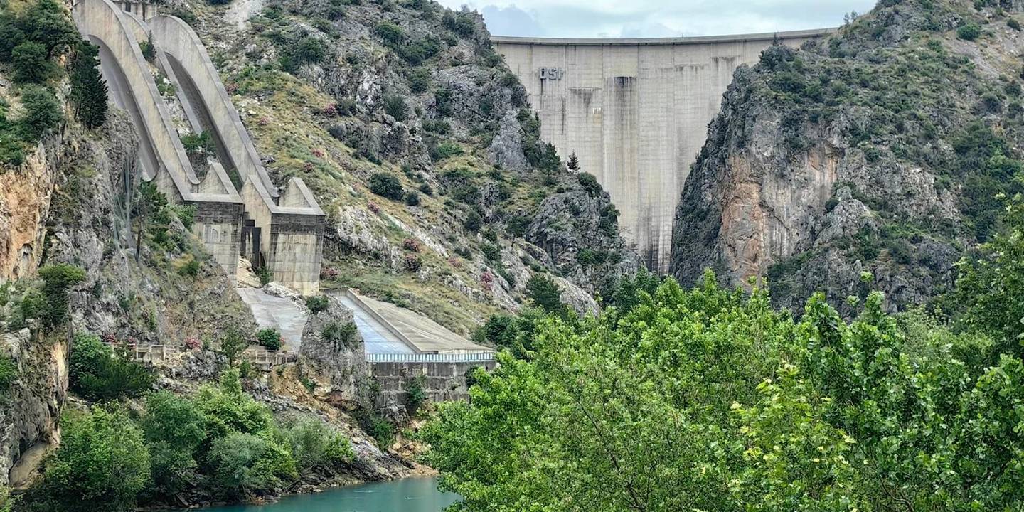
Oymapinar Dam is a large concrete arch dam and hydroelectric power facility located on the Manavgat River in Antalya’s Manavgat district. Constructed between 1977 and 1984, the dam is one of Türkiye’s notable engineering structures, with a height of approximately 185 metres, an installed capacity of 540 MW and an impressive reservoir surrounded by the Taurus Mountains. The reservoir created by the dam is home to the popular boat-tour destination known as Green Canyon. A visit to Oymapinar Dam can include panoramic viewpoints, lake cruises, nature photography and other attractions around Manavgat.
Tours and trips that go here, run by licensed local operators.
Oymapinar Dam is located on the Manavgat River, north of Manavgat in Antalya Province. The dam and Green Canyon area are approximately 20–25 kilometres from central Manavgat, depending on the route and final destination.
The main transport options are:
By car: Follow the signs for Oymapinar and Green Canyon from central Manavgat. The final sections of the road are winding, so drive carefully.
By taxi: Direct journeys are available from Manavgat and Side. Return transport may be difficult to find, so agree on waiting and return arrangements in advance.
By organised tour: Green Canyon tours with hotel transfers operate from Side, Manavgat, Alanya and Antalya.
By public transport: Local transport services to the Oymapinar area may have limited or changing routes and schedules. Check the latest information on the day of travel.
By boat tour: Boat trips begin at piers on the reservoir. Boats do not travel directly from central Manavgat to Oymapinar Dam.
Approximate distances:
| Starting point | Distance to Oymapinar Dam and Green Canyon |
|---|---|
| Manavgat town centre | 20–25 km |
| Manavgat Waterfall | 15–20 km |
| Side | 30–35 km |
| Alanya | 75–85 km |
| Antalya city centre | 90–100 km |
| Antalya Airport | 80–90 km |
When using navigation, search for Oymapinar Dam, Green Canyon, Yeşil Kanyon or the specific boat-tour pier provided by your operator. Searching only for “Oymapinar” may direct you to the village or a non-tourist section of the dam area.
There is no single standard entrance ticket covering every viewpoint around Oymapinar Dam. Boat tours, privately operated facilities, parking areas, restaurants and some recreation areas may nevertheless charge separate fees.
| Service | Information |
|---|---|
| Viewing the dam and reservoir | Generally free from accessible public areas |
| Green Canyon boat tour | Charged separately |
| Organised hotel transfer | Depends on the tour package |
| Parking | May be free or charged depending on the area |
| Restaurants and cafés | Charged separately |
| Fishing | Subject to regulations and local restrictions |
| Museum Pass | Not required or accepted |
| Hydroelectric power station | Not a standard tourist attraction |
Oymapinar Dam is an active water and energy facility. The dam wall, hydroelectric station, water intakes, power infrastructure and security zones should not be treated as ordinary sightseeing areas. Checkpoints, vehicle access and routes to viewpoints may change.
Visitors must stay on permitted roads and in publicly accessible areas. Closed gates, warning signs and instructions from security personnel must always be respected.
Joining a Green Canyon boat tour is one of the most comprehensive ways to explore Oymapinar Reservoir. Boat trips reveal the lake’s high rock walls, forested slopes and emerald-coloured water from close to water level.
Tour programmes may include some of the following:
Hotel transfers from Side, Manavgat, Alanya or Antalya
A panoramic photography stop overlooking Oymapinar Dam
Transport to the Green Canyon pier
A boat cruise across the reservoir
Swimming stops in designated areas
Lunch
Non-alcoholic drinks
A fishing stop or basic fishing equipment
Guide service and travel insurance
Programmes differ between operators. Before booking, check:
Whether your hotel is within the pickup area
The departure pier
Total excursion and boat-cruise duration
Whether swimming stops are included
Lunch and drink arrangements
Child ticket categories
Availability of life jackets and safety equipment
Weather-related cancellation conditions
Whether the tour stops at a panoramic dam viewpoint
Approximate return time
Do not swim or leave the boat near the dam wall, spillways, power facilities or water-intake structures. Swimming should take place only at stops approved by the captain.
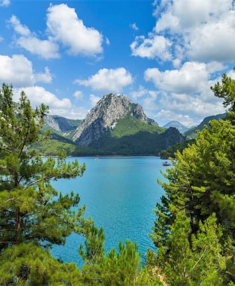
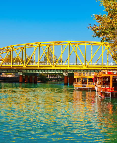
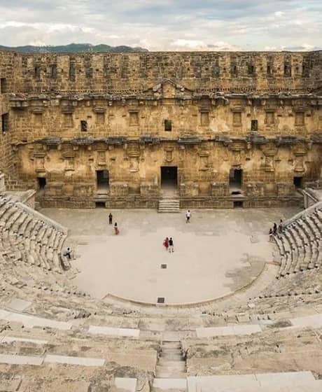
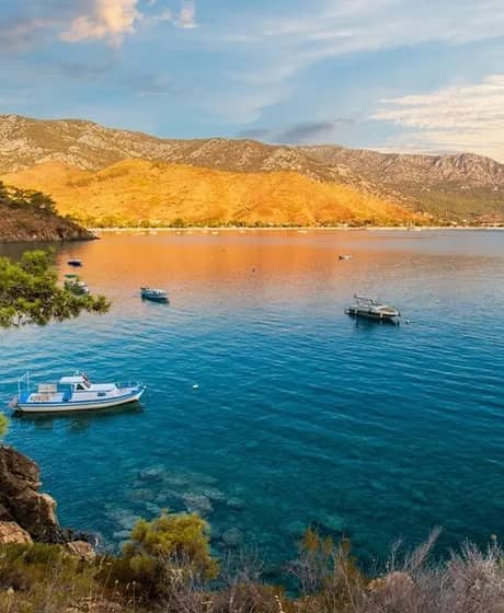
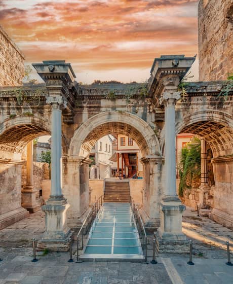
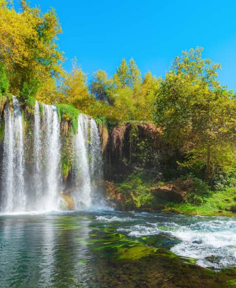
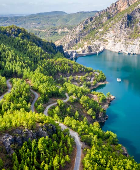
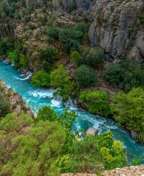
Oymapinar Dam is a major energy structure built where the Manavgat River passes through the Taurus Mountains. Its concrete arch design, approximately 185-metre height and underground hydroelectric power station make it notable from both technical and visual perspectives.
The reservoir behind the dam forms the area now widely known as Green Canyon, an important nature and boat-tour destination. Visiting Oymapinar therefore involves more than simply viewing the dam wall. Lake scenery, canyon passages, boat cruises, photography stops and surrounding restaurants are all part of the experience.
Oymapinar Dam is a concrete arch dam built on the Manavgat River primarily to generate hydroelectric power.
In an arch dam, water pressure is transferred through the curved concrete structure to the strong rock on both sides of the valley. This design makes it possible to construct high dams in narrow, rocky valleys.
The main function of Oymapinar Dam is electricity generation. Its reservoir also creates the dramatic landscapes and boat-tour routes associated with Green Canyon.
Oymapinar Dam is located in the Manavgat district of Antalya Province.
The dam lies north of central Manavgat, towards the Taurus Mountains. Tourism pages and navigation services may describe the area as Oymapinar, Oymapinar Dam, Green Canyon, Yeşil Kanyon or the Manavgat dam region.
When using navigation, confirm that the destination is Oymapinar Dam or Green Canyon in Manavgat. Similar place and neighbourhood names may appear elsewhere in Türkiye.
Oymapinar Dam is built on the Manavgat River.
The Manavgat River is fed by the Taurus Mountains and powerful karst springs before flowing south. Oymapinar Dam is the upstream one of the two major dams on the river, while Manavgat Dam is located further downstream.
After passing both dams and central Manavgat, the river reaches the Mediterranean Sea. Oymapinar Dam and Manavgat Waterfall belong to the same river system but are separate attractions.
Oymapinar Dam was constructed between 1977 and 1984 and entered operation in 1984.
The project’s planning and preparation began before the main construction period. In addition to the concrete dam wall, the development included tunnels, water-transfer systems, energy structures and an underground hydroelectric power station.
The year 1984 is generally accepted as the date when the dam and hydroelectric facility became operational.
Oymapinar Dam was developed as a public infrastructure project planned by Türkiye’s General Directorate of State Hydraulic Works, with several engineering organisations and contractors participating in its construction.
A project of this scale cannot accurately be attributed to a single person or company. Geological studies, structural design, concrete construction, tunnels, electromechanical systems and power-generation infrastructure required different areas of expertise.
The most accurate short answer is therefore that Oymapinar Dam was constructed as a major public engineering project under the coordination of the General Directorate of State Hydraulic Works.
It is misleading to say that the entire Oymapinar Dam was sold like an ordinary property; the operating rights of Oymapinar Hydroelectric Power Station were transferred to Eti Alüminyum during the privatisation process.
Oymapinar Hydroelectric Power Station entered the privatisation programme in 2003. During the subsequent process, its operating rights were considered together with Eti Alüminyum. A decision published by the Turkish Competition Authority states that the operating rights were transferred to Eti Alüminyum for 49 years.
The dam, reservoir, public ownership and operating rights of the hydroelectric station must therefore be distinguished from one another. The commonly used claim that “the dam was sold” does not fully describe the legal and operational arrangement.
Oymapinar Dam’s main features include its concrete arch structure, approximate height of 185 metres, installed capacity of 540 MW and normal reservoir capacity of 300 million cubic metres.
| Technical feature | Approximate information |
|---|---|
| Dam type | Concrete arch |
| Construction period | 1977–1984 |
| Height | 185 m |
| Dam-wall volume | 575,000 m³ |
| Normal reservoir capacity | 300 million m³ |
| Normal reservoir area | 4.70 km² |
| Installed power capacity | 540 MW |
| Annual generation capacity | Approximately 1.6 TWh |
| River | Manavgat River |
| Primary purpose | Hydroelectric power generation |
Small differences may appear between technical sources depending on their measurement methods and publication dates.
Oymapinar Dam is approximately 185 metres high.
Some technical sources measure dam height from the foundation, while others use the riverbed as their reference point. Different figures may therefore appear in technical tables.
The widely used figure of 185 metres refers to the height of the dam. It does not mean that every part of the reservoir is 185 metres deep.
Oymapinar Reservoir does not have one fixed depth that applies to the entire lake.
Water depth changes according to the former riverbed, distance from the shore, season, rainfall and operational water level. The dam wall being approximately 185 metres high does not mean that the reservoir has the same depth everywhere.
Visitors should never assume that the water is shallow during a boat trip or swimming stop. The lakebed can descend sharply even near the shore.
The elevation of Oymapinar Dam varies according to the exact point being measured.
The bottom of the dam, upper road, normal reservoir level, viewpoints and surrounding hills are all at different elevations. A single figure found online should therefore not be treated as the elevation of the entire Oymapinar area.
Visitors planning a walking or cycling route should check the elevation profile of the specific trail they intend to follow.
Oymapinar Dam’s ranking in Türkiye depends on the measurement used for comparison.
The term “largest dam” may refer to:
Dam height
Dam-wall volume
Reservoir capacity
Reservoir surface area
Installed power capacity
Annual electricity generation
In information shared by the General Directorate of State Hydraulic Works in 2023, Oymapinar was described as Türkiye’s eighth-highest dam at 185 metres and one of the country’s ten largest hydroelectric power stations by its 540 MW installed capacity. Its position can change when new dams enter operation or a different ranking method is used.
Describing Oymapinar as “Türkiye’s third-largest dam” is not a universal or reliably current ranking.
This description appears on some older tourism pages, but the measurement used is rarely specified. Oymapinar is one of Türkiye’s important high concrete arch dams, but rankings based on reservoir capacity, surface area, structural volume or electricity generation produce different results.
The most accurate approach is to specify whether the comparison concerns height, installed capacity or another measurable feature.
Oymapinar Hydroelectric Power Station is located underground near the dam structure.
Water stored in the reservoir is directed through controlled systems towards turbines. The moving water rotates the turbines, and generators connected to them convert this movement into electrical energy. The water is then released back into the Manavgat River system.
The power station has an installed capacity of approximately 540 MW. As it is an active industrial facility, it should not be considered a standard visitor attraction.
Oymapinar Reservoir is fed primarily by the Manavgat River, together with rainfall, surface runoff and powerful karst springs in the Taurus Mountains.
The limestone geology of the Manavgat basin supports extensive underground water systems. Karst springs therefore make an important contribution to the river’s flow in addition to surface rainfall.
Reservoir levels can change depending on precipitation, spring discharge, electricity generation and the facility’s operating programme.
No. Oymapinar Dam and Manavgat Dam are two separate dams built on the same river.
| Feature | Oymapinar Dam | Manavgat Dam |
|---|---|---|
| Location | Further upstream | Downstream from Oymapinar |
| Dam type | Concrete arch | Predominantly earth-fill structure |
| Height | Approximately 185 m | Lower |
| Installed capacity | 540 MW | Lower |
| Main visitor interest | Green Canyon and boat trips | Reservoir scenery and local recreation |
| Built on the same river | Yes | Yes |
Searching only for “Manavgat Dam” in a navigation application may direct visitors to the downstream reservoir rather than Green Canyon.
Green Canyon is the canyon and boat-tour area on Oymapinar Reservoir; it is not exactly the same as the dam’s technical structure.
Oymapinar Dam refers to the concrete wall, hydroelectric facility and reservoir system. Green Canyon is the common tourism name for the part of the reservoir surrounded by high cliffs and forested slopes where boat excursions operate.
The two names are often used together in tour programmes. Visitors booking a Green Canyon tour are generally taking a boat trip on Oymapinar Reservoir.
For more information, explore Maxtoria’s Green Canyon visitor guide.
The most practical ways to reach Oymapinar Dam are by car, taxi or an organised tour with hotel transfers.
From central Manavgat, follow the road north towards Oymapinar and Green Canyon. The final part of the journey may include winding roads, tunnels, narrow sections and controlled access points.
When travelling by car:
Fill the fuel tank in Manavgat or Side.
Download an offline map.
Obtain the exact pier location before departure.
Plan your return journey in advance.
Take extra care on winding roads after dark.
Do not enter closed or security-controlled roads.
Oymapinar Dam and Green Canyon are approximately 20–25 kilometres from central Manavgat.
The exact distance depends on the selected viewpoint, boat pier or restaurant. The journey normally takes around 35–50 minutes, although summer traffic, roadworks and mountain-road conditions can increase the travel time.
Selecting the exact business or pier in your navigation application will provide a more accurate route than entering only the name of the dam.
The driving distance between Manavgat Waterfall and Oymapinar Dam is approximately 15–20 kilometres, depending on the selected destination.
Both places can be included in the same day. Visitors may see Manavgat Waterfall in the morning before continuing to a panoramic viewpoint or Green Canyon pier.
If the boat tour has a fixed departure time, plan the waterfall visit around the required meeting time.
From Antalya city centre, follow the D400 road towards Manavgat and then turn north towards Green Canyon and Oymapinar Dam.
The journey may cover approximately 90–100 kilometres, depending on the starting point, and can take close to two hours in traffic. Visitors travelling only for a panoramic stop should also consider the total return journey.
A full-day tour with transfers may be more practical for travellers who do not want to drive on the mountain roads.
From Side, Oymapinar Dam can be reached by travelling through Manavgat and continuing north towards Green Canyon.
The distance from Side to the Green Canyon area is approximately 30–35 kilometres. The drive normally takes around 45–60 minutes.
Organised tours from Side often combine hotel transfers, a panoramic dam stop, a boat cruise and lunch in one full-day programme.
There is no single standard entrance fee for viewing the dam and reservoir from accessible public areas.
The following services may require payment:
Green Canyon boat tours
Privately operated viewpoints or recreation areas
Parking
Restaurants and cafés
Organised transfers
Guided excursions
Fishing or equipment services
Photography and private-event services
The Museum Pass is not used at Oymapinar Dam and does not cover boat-tour charges.
The tourist areas around Oymapinar Reservoir and Green Canyon can be visited, but the dam’s technical and security-controlled sections are not open to the public.
Roads across or around the dam, energy facilities, tunnels and viewpoints may be temporarily closed according to operational and security conditions.
Checking current access information with the tour operator, facility or local authorities before travelling is recommended.
Oymapinar Dam boat tours depart from lake piers in the Green Canyon area.
The departure point depends on the tour operator and programme. Some packages collect guests from their hotels and transport them directly to the correct pier.
Independent visitors should request the following before travelling:
Exact pier location
Parking information
Meeting time
Boat name
Contact number for the tour representative
Procedure for late arrival
The Green Canyon boat cruise usually lasts several hours, while a complete programme with transfers and lunch generally takes approximately 5–7 hours.
The total duration depends on the departure region. Tours beginning in Antalya or Alanya can be longer because of hotel-transfer times.
The advertised excursion duration may not equal the time spent on the boat. Check the total programme, cruise, lunch and transfer durations separately.
Oymapinar Dam and Green Canyon boat-tour prices vary according to the season, departure area, transfers and services included in the package.
When comparing prices, check whether the following are included:
Hotel transfers
Lunch
Drinks
Entry and pier charges
Insurance
Guide service
Fishing equipment
Photography services
Child seats
Cancellation and amendment rights
For current prices and availability, explore the Green Canyon Boat Trip from Side.
Swimming should take place only in areas approved as safe by the captain or local operator.
Reservoir shorelines can descend suddenly. Cold layers of water, submerged rocks, currents and operational changes in water level can create additional risks.
Do not swim near:
The dam wall
Spillways
Power facilities
Water-intake structures
Areas with heavy boat traffic
Shores marked with warning signs
Stops where the captain has not given permission
Even confident swimmers should follow life-jacket instructions when entering the water from a boat.
Fishing at Oymapinar Reservoir is permitted only within current recreational-fishing regulations and local restrictions.
Closed seasons, permitted species, daily limits and equipment rules may change. Fishing must not take place near the dam wall, power station or water-intake structures.
If fishing is included in a boat tour, ask the operator about equipment, relevant rules and what happens to any fish caught.
Carp and various other freshwater fish may be found in Oymapinar Reservoir.
The distribution of species can change according to natural populations, stocking programmes, water temperature and seasonal ecological conditions. Lists published online may not always be current or based on scientific surveys.
Anglers should consult the latest recreational-fishing regulations issued by the Ministry of Agriculture and Forestry for current species and catch restrictions.
Restaurants and facilities offering breakfast or picnic-style services may operate around Oymapinar Dam, but not every section of the shoreline is an authorised picnic area.
Private facilities may provide tables, breakfast, restaurant or recreation services on a seasonal basis. Rules concerning fires can change according to the level of wildfire risk.
Visitors should:
Use only permitted areas.
Never light a fire without explicit permission.
Take all rubbish away.
Avoid driving onto the shoreline.
Never enter private property without permission.
Follow all wildfire warnings.
Restaurants and recreation facilities can be found near the Green Canyon piers and around Oymapinar.
Some boat tours serve lunch at a lakeside restaurant. Independent visitors should check seasonal opening hours and reservation conditions before travelling.
Menus may include grilled dishes, salads, pasta or local breakfast options. A set menu included in a tour may differ from the restaurant’s standard menu.
Oymapinar Dam and its reservoir can be seen from several panoramic points, but not every viewpoint is an official or permanently accessible viewing terrace.
Tour programmes often include a photography stop overlooking the dam or Green Canyon. Access roads may change because of security, maintenance or traffic arrangements.
Do not stop in an uncontrolled position on the roadside, cross safety barriers or block traffic while taking photographs.
The water level and reservoir occupancy rate at Oymapinar Dam are not fixed; they change according to rainfall, spring discharge, electricity generation and the season.
Publishing one percentage as permanent information in an evergreen visitor guide would be misleading. Total reservoir occupancy, active usable capacity and operational water level are also different measurements.
When checking current data, examine the publication date, source and whether it refers to active storage or total capacity. The most reliable information comes from dated announcements by the General Directorate of State Hydraulic Works and other official authorities.
An uncontrolled failure of any large dam could create serious flooding and infrastructure risks downstream; this general engineering fact does not indicate that Oymapinar Dam is currently unsafe.
Dams are monitored through measurement systems, engineering inspections, maintenance and emergency planning. Unverified online claims that a dam is about to fail or that its gates have been opened should not be treated as reliable information.
In a genuine emergency:
Follow announcements from AFAD and other official authorities.
Obey instructions from security and emergency personnel.
Stay away from riverbeds and closed roads.
Do not circulate unverified social-media reports or footage.
Visitors should use only public roads, authorised piers and areas designated as safe by local operators.
Important safety rules include:
Do not approach the dam wall or power facilities without permission.
Never cross security gates or barriers.
Do not swim near spillways or water-intake structures.
Follow life-jacket instructions during boat trips.
Supervise children at all times near the shore and on boats.
Do not cross barriers at high viewpoints.
Check current aviation and facility-security rules before flying a drone.
Do not light fires during periods of wildfire risk.
Do not go onto the reservoir in unsuitable weather.
Oymapinar Dam can be seen throughout the year, although spring to autumn is generally the most suitable period for boat trips and nature excursions.
Spring: Green landscapes, comfortable temperatures and potentially strong water flow
Summer: Regular boat programmes, but hotter weather and more visitors
Autumn: Quieter surroundings and more comfortable walking conditions
Winter: Fewer visitors, although rain and tour cancellations are more likely
Morning: Calmer water and softer photography light
Afternoon: Swimming and relaxation stops depending on the programme
Check the weather, wind and tour status before travelling for a boat trip.
Green Canyon boat tours can be suitable for families with children when appropriate safety measures are provided.
Before booking, ask about:
Child-size life jackets
Whether pushchairs can be taken aboard
Toilet facilities
Shaded seating
Lunch options
Transfer duration
Child ticket age categories
Rules during swimming stops
Children must remain under constant supervision on piers, near high shorelines and on the boat deck.
The best Oymapinar Dam photographs can be taken from panoramic viewpoints and along the Green Canyon boat route.
Photography tips include:
Use a wide-angle lens to include both the dam wall and valley.
Wait for reflections of the canyon walls during the boat trip.
Visit in the morning for a calmer water surface.
Use a polarising filter to manage bright reflections.
Keep phones and cameras secure while on the boat.
Do not stop in unsafe positions beside the road.
Never climb over barriers.
Check current regulations and facility restrictions before flying a drone.
Visitor reviews most frequently mention Green Canyon’s water colour, high rock walls, peaceful boat trips and panoramic scenery.
Commonly praised features include:
The reservoir’s emerald colour
Taurus Mountain scenery
The calm atmosphere of the boat cruise
Photography opportunities
Summer swimming stops
Convenient day trips from Side and Manavgat
Common concerns include long transfer times, busy tour boats, seasonal crowds, winding roads and differences between the services included in each package.
When booking, look beyond the overall rating and read recent reviews for the same departure area and tour programme.
Oymapinar Dam can be combined with nature, historical and coastal attractions around Manavgat and Side.
Nearby places include:
Green Canyon
Manavgat Dam
Manavgat Waterfall
Manavgat River
Ancient City of Side
Temple of Apollo
Side Museum
Titreyengöl
Sorgun Forest
Köprülü Canyon
Tazı Canyon
Ancient City of Lyrbe or Seleukeia
Altınbeşik Cave
Buttoned Houses
For more route ideas, explore Maxtoria’s guides to the best places to visit in Side and the best places to visit in Antalya.
An Oymapinar Dam visit can be planned as a short panoramic stop or a full-day excursion including a Green Canyon boat cruise.
A sample full-day itinerary:
Morning departure from Side or Manavgat
Visit to Manavgat Waterfall
Drive towards Oymapinar Dam
Panoramic photography stop
Arrival at the Green Canyon pier
Boat cruise
Lunch
Swimming or relaxation stop in an authorised area
Evening return to Side or Manavgat
One or two hours may be enough for visitors who only want to see the scenery. Those joining a boat trip should reserve most of the day once transfers are included.
Visitors who want to explore Oymapinar Reservoir from the water should choose a tour that clearly includes Green Canyon in its itinerary.
Before booking, check:
Whether your hotel is within the transfer area
Pickup and return times
Panoramic dam stop
Boat-cruise duration
Swimming and fishing stops
Lunch and drink arrangements
Child ticket conditions
Life jackets and safety equipment
Weather-related cancellation policy
What you need to bring
Explore the Green Canyon Boat Trip from Side or compare more options on the Side tours and activities page.
Our easy-to-use app offers a comprehensive listing of curated tours, activities, and experiences, all in one place. Whether you’re a thrill-seeker looking for an adrenaline-packed adventure or seeking a more relaxed getaway, Maxtoria has got you covered.





© 2026 Maxtoria Turizm Ticaret A.Ş. — All Rights Reserved
v2.1.2