



Bazaar
Manavgat River Cruise from Antalya: Swim, Waterfall and Bazaar
Free Cancellation Free Shuttle
From £31.96 £28.39 Per Person



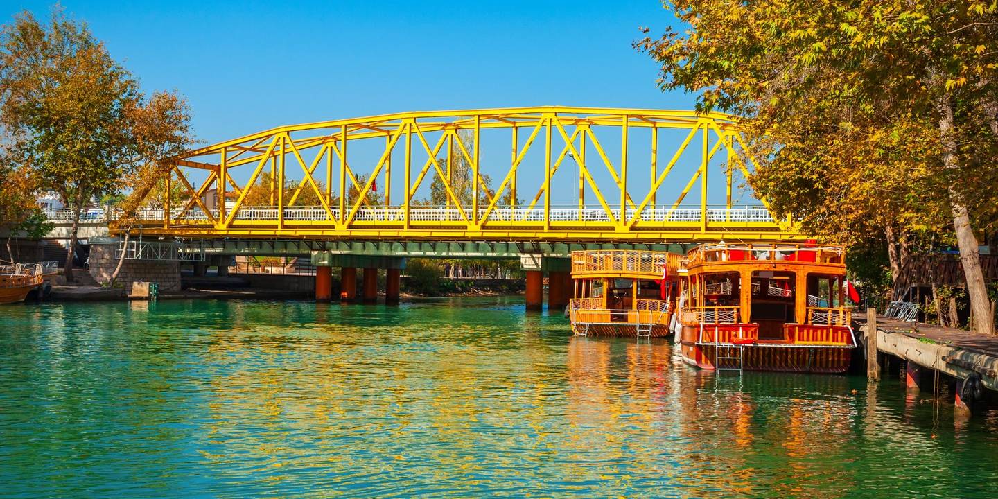
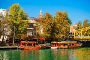
The Manavgat River is an approximately 93-kilometre-long waterway fed by karst springs in the Western Taurus Mountains. It flows through Antalya’s Manavgat district before reaching the Mediterranean Sea in the Sorgun Boğazı area. Known as Melas in ancient times, the river is one of the region’s most important natural features and is associated with Manavgat Waterfall, Oymapınar Dam, Green Canyon and rich riverside vegetation. Boat tours along the river offer views of wooded banks, fishing boats, the river mouth and the point where the freshwater meets the Mediterranean. Some programmes also include Manavgat Bazaar, Manavgat Waterfall, lunch and swimming breaks. The lower sections passing through the town centre are easy to visit, while separate road routes or specialised boat tours are required for the canyons and reservoirs.
Tours and trips that go here, run by licensed local operators.
The Manavgat River is located in Antalya’s Manavgat district and flows through the town centre before reaching the Mediterranean Sea in the Sorgun Boğazı area. It is not possible to see the entire river from a single visitor point. The town centre, Manavgat Waterfall, Oymapınar Dam, Green Canyon and the river mouth are all on different routes.
The main transport options are:
To Manavgat town centre: Travel along the Antalya–Alanya D400 road by car, bus or minibus.
To Manavgat Waterfall: Use public transport travelling towards the waterfall, take a taxi or drive from the town centre.
To the river mouth: Follow the Sorgun–Titreyengöl–Boğaz route. Current minibus services should be checked on the day of travel.
To the boat harbour: Go to the Manavgat boat harbour or meeting point specified in your tour reservation.
To Oymapınar Dam and Green Canyon: Follow the Oymapınar road north from central Manavgat.
With an organised tour: Join a transfer-included Manavgat River, bazaar and waterfall excursion from Side or surrounding resorts.
Approximate distances:
| Starting point | Approximate distance to the Manavgat River area |
|---|---|
| Manavgat town centre | The river passes through the town centre |
| Side | 5–10 km |
| Titreyengöl | 5–10 km |
| Manavgat Waterfall | 3–5 km from the centre |
| Oymapınar Dam | 20–25 km from the centre |
| Alanya | 60–70 km |
| Antalya Airport | 60–70 km |
| Antalya city centre | 70–80 km |
Searching only for “Manavgat River” in a navigation application may direct you to different points. Depending on the section you want to visit, search for Manavgat Waterfall, Manavgat Boat Harbour, Manavgat Boğazı, Oymapınar Dam or Green Canyon.
Viewing the Manavgat River from bridges and public riverside areas in the town centre is free. The river itself does not have a standard admission ticket or fixed opening hours.
Boat tours, the waterfall area, car parks and private facilities around the reservoirs may apply separate charges.
| Service | Information |
|---|---|
| Public riverside areas in the town centre | Free |
| River views from bridges | Free |
| Manavgat River boat tour | Charged according to the programme |
| Hotel transfer | Included or charged separately depending on the tour |
| Lunch | Included on some tours |
| Drinks | Usually charged separately |
| Manavgat Waterfall | Current admission arrangements should be checked |
| Green Canyon boat tour | Charged as a separate excursion |
| Parking | May be charged depending on the area used |
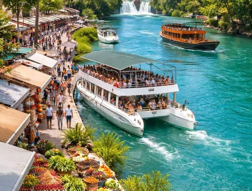
Manavgat River boat tours generally operate along the lower sections of the river. Programmes may include a river cruise, the point where the river meets the Mediterranean, a swimming break, lunch, Manavgat Bazaar and an optional visit to the waterfall.
Before booking, check:
Hotel pickup areas
The departure point
Total tour duration
Duration of the boat journey
Whether the river mouth is visited
Where the swimming break takes place
Whether Manavgat Waterfall is included
Time allocated for the bazaar
Lunch and drinks
Child ticket conditions
Cancellation and weather policies
Estimated return time to the hotel
The Manavgat River is fed by karst springs on the eastern and southern slopes of the Western Taurus Mountains and reaches the Mediterranean Sea in the Sorgun Boğazı area of Manavgat. Its source system does not consist of one surface spring.
The river receives water from karst springs associated with Akdağ near Akseki, the southern side of the Gembos closed basin, mountainous areas south of Lake Beyşehir and several underground water systems. Dumanlı Spring, formerly one of the river’s most powerful sources, was submerged after the creation of the Oymapınar Reservoir.
As the river travels south from the mountainous and canyon landscape, it:
Receives water from karst springs.
Passes through Oymapınar Reservoir.
Reaches Manavgat Dam.
Forms Manavgat Waterfall.
Flows through Manavgat town centre.
Reaches the alluvial coastal plain.
Enters the Mediterranean at Sorgun Boğazı.
Freshwater and seawater meet at the mouth of the Manavgat River. Visitors on boat tours may therefore notice a clear difference between the temperatures of the river and the sea.
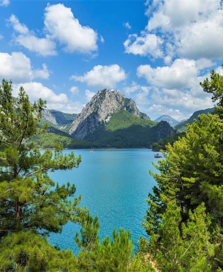
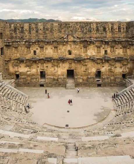
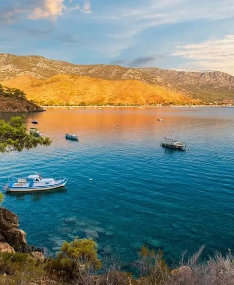
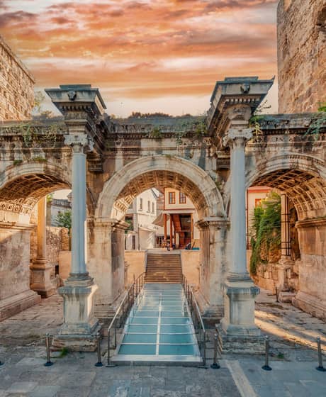
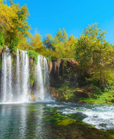
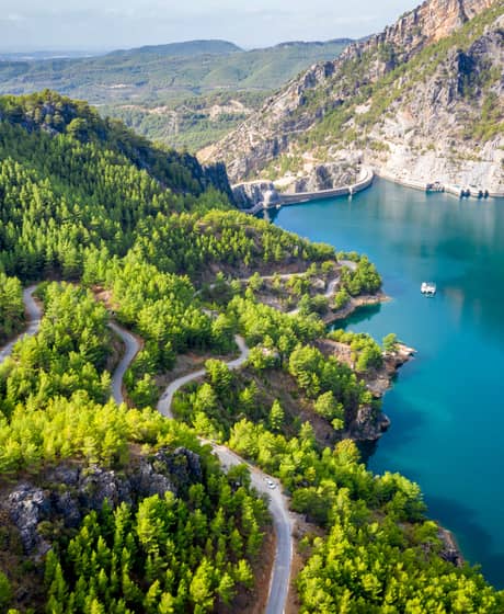
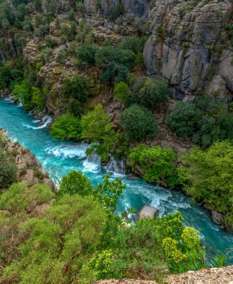
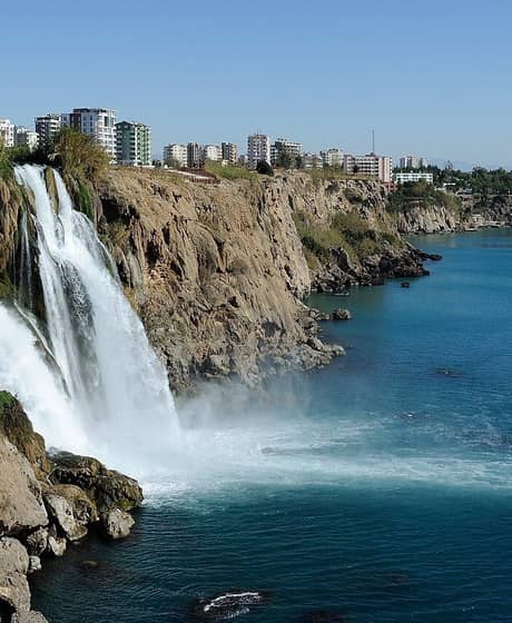
The Manavgat River is one of Antalya’s important high-flow waterways and carries water throughout the year. Water from the karst systems of the Western Taurus Mountains travels through mountain canyons and reservoirs before reaching the Manavgat Plain.
The river is more than the water source that forms Manavgat Waterfall. Oymapınar Dam, Green Canyon, riverside habitats, boat tours, fishing, agriculture and the region’s biodiversity are all connected to the Manavgat River.
The Manavgat River is an approximately 93-kilometre-long waterway that originates in the Western Taurus Mountains and reaches the Mediterranean Sea in Antalya’s Manavgat district.
Because a significant proportion of its water comes from underground karst systems, the river’s flow is not solely dependent on surface rainfall. This helps it maintain a strong flow throughout the year.
The Manavgat River may also be referred to as:
Manavgat Çayı
Manavgat Irmağı
Manavgat waterway
Manavgat River
Melas River
The Turkish names “Manavgat Çayı”, “Manavgat Irmağı” and “Manavgat Nehri” all refer to the same river.
The Manavgat River is located within Antalya Province and flows largely through the district of Manavgat. It begins in the source areas of the Taurus Mountains in the north and travels south.
Along its course, the river passes through canyons, Oymapınar and Manavgat reservoirs, Manavgat Waterfall and the town centre. It eventually reaches the Mediterranean in the area known as Manavgat Boğazı.
The Manavgat River is in Türkiye’s Mediterranean Region. Its basin extends between the karst landscape of the Taurus Mountains and Antalya’s coastal plain.
Tourist destinations such as Side, Sorgun, Titreyengöl, Oymapınar and Green Canyon are close to different sections of the river.
The Manavgat River is fed by numerous springs, underground water systems and small tributaries in the Western Taurus Mountains.
Its source areas are generally associated with:
Mountainous areas around Akseki
Akdağ, northwest of Cevizli
Mountains south of Lake Beyşehir
The southern side of the Gembos closed basin
Karst underground water systems in the Taurus Mountains
The beginning of the river should therefore not be understood as one clearly defined spring of the type associated with some major rivers.
The Manavgat River does not flow directly out of the surface of Lake Beyşehir. Its sources are associated with mountainous and karst landscapes south of the lake.
Water can travel underground for long distances through the permeable limestone layers of the Taurus Mountains. Water infiltrating from some closed basins is thought to contribute to the karst springs that feed the Manavgat River.
This hydrogeological connection does not mean that the river flows directly from Lake Beyşehir.
The Manavgat River reaches the Mediterranean Sea in the Sorgun Boğazı area, southeast of Manavgat town centre.
The river mouth is locally known as Manavgat Boğazı or simply Boğaz. Here, the river’s cool freshwater meets the warmer saltwater of the Mediterranean.
Boat tours frequently approach this point and may stop for swimming along the coastal strip when weather and sea conditions are suitable.
The Manavgat River flows into the Mediterranean Sea, geographically reaching the eastern part of the Gulf of Antalya.
The river mouth is east of Side and southeast of Manavgat town centre. The surrounding coastal area is known for its sandy strips, reed beds and birdlife.
The generally accepted length of the Manavgat River is approximately 93 kilometres.
Small variations may appear depending on which source branch is used as the starting point. Some sources therefore describe the river as approximately 90 kilometres long.
Despite its relatively short length, its powerful flow and karst water sources make it one of Türkiye’s important rivers.
There is no single depth measurement that applies to the entire Manavgat River.
Its depth changes according to:
The section being measured
Seasonal water levels
Dam water management
Rainfall
The width of the riverbed
Seawater influence at the river mouth
Changes made to the banks and riverbed
The waterfall, town centre, boat harbour and river mouth all have different depths. The depth of Oymapınar Reservoir should not be confused with that of the natural river channel.
Even where the water looks calm, strong currents and sudden depth changes may be present. Visitors should not swim outside designated areas.
The main features of the Manavgat River include:
It is approximately 93 kilometres long.
It is fed by karst springs in the Western Taurus Mountains.
It maintains a strong flow throughout the year.
It forms Manavgat Waterfall.
Oymapınar and Manavgat dams are located on the river.
It passes through Manavgat town centre.
It forms a broad river mouth where it reaches the Mediterranean.
It provides habitats for fish, birds and riverside plants.
It is used for boat tours, canoeing and outdoor activities on selected sections.
It is important for agriculture, energy production and water-resource management.
The river has played a defining role in Manavgat’s natural and economic development.
Depending on the measuring point and study period, the Manavgat River’s long-term average flow is commonly given as approximately 147–160 cubic metres per second.
Rainfall, karst spring discharge, dam operations and seasonal conditions can affect the flow. A measurement taken at one time should therefore not be regarded as representative of the entire year.
Despite its limited length, the amount of water it carries makes the Manavgat River one of the Mediterranean Region’s most powerful waterways.
The Manavgat River is fed not only by large, named surface tributaries but also by numerous small streams, springs and underground water sources in the Taurus Mountains.
Dumanlı Spring was historically regarded as one of its most important karst sources. The spring became submerged after the Oymapınar Reservoir was created.
Because the river has a karst water system, its visible surface tributaries do not explain the entire drainage area. Underground water also makes a significant contribution to its flow.
Two major dams are located on the main course of the Manavgat River:
| Dam | Location and main characteristics |
|---|---|
| Oymapınar Dam | A high arch dam in the upper section, known for energy production and the scenery of Green Canyon |
| Manavgat Dam | Located downstream from Oymapınar and used to regulate the river and generate electricity |
The reservoirs affect the river’s natural flow, water levels and surrounding ecosystems. Green Canyon boat tours operate in the canyon section of Oymapınar Reservoir.
No. Oymapınar Dam and Manavgat Dam are two separate structures on the same river.
Oymapınar Dam is situated farther north of Manavgat in a narrow, high canyon. The boat routes promoted as Green Canyon are connected to this reservoir.
Manavgat Dam is downstream from Oymapınar and closer to the town centre. The two dams have different access routes, landscapes and visiting arrangements.
Yes. Green Canyon is the name commonly used for the canyon section of Oymapınar Reservoir on the Manavgat River.
Green Canyon excursions are different from the boat tours operating along the lower section of the Manavgat River near the Mediterranean.
| Feature | Manavgat River boat tour | Green Canyon boat tour |
|---|---|---|
| Area | Lower river near the town centre and Mediterranean | Oymapınar Reservoir |
| Main scenery | Riverbanks, delta and Mediterranean coastline | Mountains, reservoir and canyons |
| Swimming | River mouth or designated stops | Suitable areas within the reservoir |
| Additional stops | Bazaar and Manavgat Waterfall | Canyon scenery and reservoir stops |
| Tour style | River, sea and shopping | Nature and reservoir scenery |
Check which waterway is included before booking your tour.
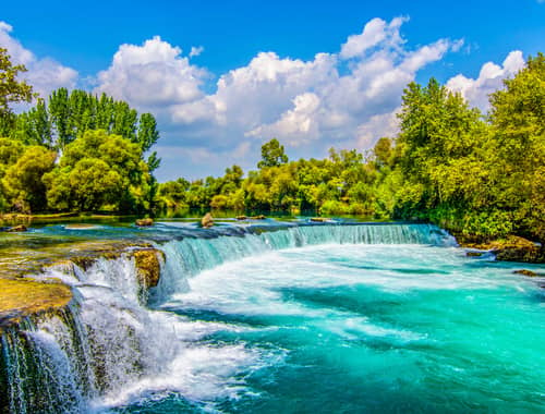
No. Manavgat Waterfall is a natural attraction formed where the Manavgat River flows over a broad series of low rock steps.
The river is an approximately 93-kilometre-long water system. The waterfall is one specific visitor point along its course.
Manavgat Waterfall is approximately 3–5 kilometres north of the town centre. River boat tours generally operate downstream from the waterfall and do not travel over it.
Public riverside areas and bridges in Manavgat town centre can be visited free of charge. There is no general admission ticket for the river.
Services that may require payment include:
Boat tours
Private yacht or boat hire
Manavgat Waterfall visits
Green Canyon excursions
Parking
Restaurants and cafés
Organised fishing or water-sports activities
Hotel transfers
Guided day tours
Prices may vary according to the season, operator and services included.
First decide which section of the Manavgat River you want to visit.
For the town centre: Set your destination as central Manavgat.
For the waterfall: Use the Manavgat Waterfall navigation point.
For a boat tour: Go to the harbour or meeting point shown on your reservation.
For the river mouth: Follow the Sorgun–Titreyengöl–Manavgat Boğazı route.
For Green Canyon: Travel towards Oymapınar and Green Canyon.
For a transfer-included tour: Confirm whether your hotel is within the pickup area.
Traffic and parking congestion may occur around the town centre, waterfall and Boğaz during summer.
Side is approximately 5–10 kilometres from Manavgat town centre. Visitors can travel by car, taxi, minibus or a tour that includes hotel transfers.
River excursions from Side commonly combine some of the following:
Hotel pickup
Transfer to Manavgat boat harbour
River cruise
Swimming break at the river mouth
Lunch
Manavgat Bazaar
Manavgat Waterfall
Return to the hotel
Not every tour follows the same programme. Check separately whether the waterfall visit and admission are included.
Manavgat can be reached from Antalya city centre along the D400 road. Depending on traffic and the starting point, the journey generally takes approximately 1–1.5 hours.
Buses travelling towards Manavgat depart from Antalya Bus Station. From Manavgat Bus Station, visitors can continue by local transport towards the town centre, waterfall, Side or Sorgun.
Private transfers, car hire and connecting bus services are also available from Antalya Airport.
The road distance between Alanya and Manavgat is approximately 60–70 kilometres. Visitors can travel along the D400 road by car, intercity bus or a transfer-included tour.
Visitors arriving from Alanya can combine Manavgat town centre, the waterfall and a river cruise on the same day. Green Canyon requires an additional journey north from the town centre.
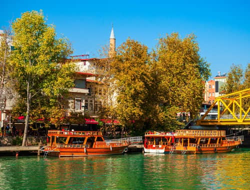
Most river cruises depart from harbours and piers used by tour boats along the lower section of the Manavgat River.
Although some excursions are advertised as departing from Side, tour vehicles usually collect guests from hotels in Side and transport them to the boat harbour in Manavgat.
The exact departure location varies between operators. Check the harbour, transfer time and meeting point shown on your reservation.
A typical tour programme may include:
Pickup from hotels in Side and surrounding areas
Transfer to Manavgat boat harbour
Boat journey along the river
Views of wooded riverbanks and fishing boats
Arrival at Manavgat Boğazı
Swimming break on the river or sea side
Lunch on board
Free time at Manavgat Bazaar
Optional visit to Manavgat Waterfall
Return to the hotel
The route may change according to weather, water levels, the operator and the tour version purchased.
The boat journey alone may last several hours. Programmes that include hotel transfers, lunch, swimming, the bazaar and the waterfall are usually organised as full-day excursions.
Approximate durations:
| Programme | Estimated duration |
|---|---|
| Short river cruise | 1–3 hours |
| Boat and swimming programme | 3–5 hours |
| Boat, bazaar and waterfall tour | 6–8 hours |
| Tour with transfers from distant resorts | 8 hours or longer |
The itinerary and transfer schedule on the tour page should be used for the exact duration.
There is no single fixed price applicable to all Manavgat River boat tours. Prices vary according to:
Tour date
Departure area
Shared or private boat
Hotel transfer
Lunch
Drinks
Waterfall visit
Guide service
Child age categories
Total duration
Season and availability
Check the current price, availability and included services during booking.
Swimming is not safe along every section of the Manavgat River. Currents, sudden depth changes, cold spring water, boat traffic and dam operations can create risks.
Swimming breaks during boat tours take place in areas selected by the captain and specified in the programme. Where the river meets the Mediterranean, visitors may sometimes be able to choose between the freshwater and sea sides.
Do not enter the water at uncontrolled riverside locations, areas with warning signs or sections with strong currents.
Rafting and canoeing may be possible along selected upper sections of the Manavgat River when conditions are suitable. However, conventional sightseeing cruises in the tourist centre of Manavgat are not rafting activities.
Many rafting tours sold around Side and Manavgat take place on the Köprüçay River in Köprülü Canyon. Confirm which river the activity uses before booking.
The Manavgat River is not a national waterway used for regular passenger or freight transport.
Its lower sections are mainly used for:
Tourist boat trips
Fishing boats
Small private boats
Local pier activities
Recreational watercraft
Dams, the waterfall, changing depths and the structure of the riverbed prevent uninterrupted navigation along the entire river.
The Manavgat River and its mouth contain freshwater, brackish-water and marine-influenced habitats.
Fish recorded in the river and surrounding waters include:
Trout
Carp
Mullet
Sea bass
Blackfish
European eel
Other species adapted to the river-mouth environment
Species distribution changes between the upper river, reservoirs, town centre and sections close to the sea. Current fishing restrictions, minimum sizes and permit requirements should be checked before fishing.
The river, reed beds, wooded banks, reservoirs and river mouth create several different bird habitats.
Species that may be seen include:
Moorhens
Ducks
Geese
Kingfishers
Herons
Gulls
Cormorants
Migratory waterbirds
Morning is generally quieter for birdwatching. Visitors should not approach nesting areas and must check current regulations before using a drone.
The riverbanks support a rich variety of plants adapted to water and damp soil.
Common trees and vegetation include:
Willows
Plane trees
Poplars
Mulberry trees
Elms
Reed-bed plants
Riverside shrubs
Citrus groves and agricultural areas
The vegetation changes between the upper canyons and the coastal plain.
The Manavgat River was known as Melas in ancient times. This Greek-derived name is associated with the meaning “black” or “dark-coloured”.
Ancient sources also referred to the Melas River in connection with the geographical boundary between Pamphylia and Cilicia.
The name Melas primarily refers to the river. It does not mean that the modern town of Manavgat was itself an ancient city named Melas.
No. The Manavgat River and Aksu River are two separate waterways in Antalya Province.
| Feature | Manavgat River | Aksu River |
|---|---|---|
| Main district | Manavgat | Aksu and surrounding areas |
| Coastal area | Manavgat and Sorgun coast | Aksu coast in Antalya |
| Main attraction | Manavgat Waterfall | Perge and the Aksu basin |
| Main tourist use | River and reservoir excursions | Coastal and regional nature areas |
The names may be confused because educational and map-related searches often list Antalya’s rivers together.
The Manavgat River can be visited throughout the year. The best period depends on your planned activity.
Spring: The landscape is greener and temperatures are suitable for walking.
Summer: This is the busiest season for boat tours, although afternoons can be very hot.
Autumn: Sea and air temperatures often remain suitable for boat trips.
Winter: River views remain accessible, but boat services may be limited.
Morning: Cooler temperatures and quieter riverbanks may be available.
Weekdays: The waterfall, bazaar and boats may be less crowded.
Check the rain, wind and tour availability before booking a river or Green Canyon excursion.
Manavgat River boat tours can be suitable for families when the vessel’s safety equipment and programme duration meet the family’s needs.
Before booking, check:
Child-sized life jackets
Shaded areas on the boat
Toilet facilities
Pushchair storage
Total tour duration
Depth at swimming stops
Lunch options
Boarding conditions
Child ticket age categories
Hotel transfer duration
Children must remain under constant supervision on boats, piers and riverbanks.
Depending on the selected visitor area, facilities may include:
Boat tours
Restaurants
Cafés
Fish restaurants
Walking areas
Viewpoints
Parking
Public transport stops
Bazaars and markets
Toilets
Picnic areas
Waterfall visits
Green Canyon tours
Private transfer services
Facilities may be more limited around the river mouth and reservoirs than in the town centre.
Popular photography locations include:
Manavgat Waterfall
Bridges in the town centre
Riverside walking areas
The boat-tour route
Manavgat Boğazı
The point where the river meets the sea
Oymapınar Dam
Green Canyon
Sorgun and Titreyengöl
Morning may provide softer light and a calmer water surface. The river mouth and Mediterranean side can offer warmer colours around sunset.
Phones and cameras should not be held beyond boat railings and must be protected from water spray.
Features frequently praised in visitor reviews include:
Peaceful river scenery
The point where the river meets the sea
The relaxing atmosphere of boat tours
Manavgat Waterfall
The bazaar visit
Green Canyon scenery
Family-friendly tour options
Nature photography
Swimming breaks
Common concerns include summer crowds, hot weather, music volume on some boats, drink prices, long transfer times and busy tour programmes.
For a quieter experience, consider a weekday or an early departure.
Attractions around the Manavgat River include:
Manavgat Waterfall
Ancient Side
Temple of Apollo
Ancient Theatre of Side
Side Museum
Manavgat Bazaar
Sorgun Forest
Titreyengöl
Manavgat Boğazı
Oymapınar Dam
Green Canyon
Seleukeia Ancient City
Köprülü Canyon
Tazı Canyon
Aspendos Ancient Theatre
For additional route ideas, explore Maxtoria’s guide to the best places to visit in Manavgat.
A full-day itinerary around Manavgat can be organised as follows:
Visit Manavgat Waterfall in the morning.
See the river in the town centre.
Spend a short time at Manavgat Bazaar.
Join a river boat tour in the afternoon.
See where the river meets the sea at Manavgat Boğazı.
Take a swimming break if included in the programme.
Continue to Ancient Side and the Temple of Apollo at the end of the day.
Visitors who also want to see Green Canyon should consider allocating a separate day. Green Canyon is not on the same tour route as the lower section of the Manavgat River near the sea.
Recommended items to bring include:
Swimwear
A towel
Sun cream
A hat
Non-slip footwear
Water
A waterproof phone case
Cash for small expenses
A light layer during spring and autumn
Visitors who want to combine the Manavgat River with a boat trip, bazaar and surrounding natural attractions can explore the Manavgat Boat Tour and Bazaar Cruise from Side.
For an alternative programme combining the waterfall, bazaar and river cruise, consider the Manavgat Boat Cruise from Side with Bazaar and Waterfall.
Travellers interested in reservoir and canyon scenery can choose the Green Canyon Boat Trip from Side.
Before booking, check:
Hotel pickup areas
Departure time
Boat-tour duration
Whether the route follows the river or Green Canyon
Manavgat Waterfall visit
Free time at the bazaar
Swimming breaks
Lunch
Drinks
Guide service
Child age categories
Cancellation and weather conditions
Estimated return time
Compare more options on the Side tours and activities page.
Our easy-to-use app offers a comprehensive listing of curated tours, activities, and experiences, all in one place. Whether you’re a thrill-seeker looking for an adrenaline-packed adventure or seeking a more relaxed getaway, Maxtoria has got you covered.




© 2026 Maxtoria Turizm Ticaret A.Ş. — All Rights Reserved
v2.1.2